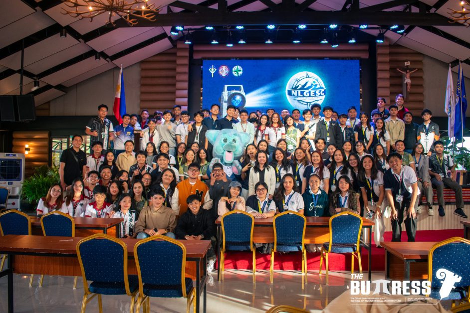
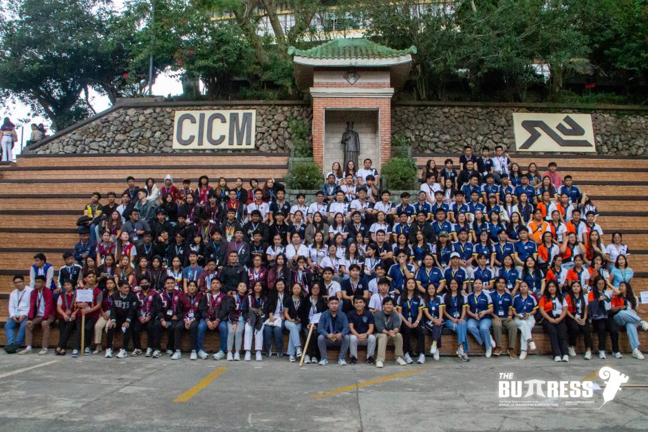
The Association of Geodetic Engineering Students (AGES), in association with the Saint Louis University (SLU) School of Engineering and Architecture Performing Arts Group (SEA PAG) and the Geodetic Engineering Students Association – University of Saint Louis Tuguegarao Chapter (GESA-USLT), successfully concluded its 10th annual North Luzon Geodetic Engineering Students Conference (NLGESC) with the theme “Masakbayan: Seeing Beyond Maps, A Decade of Shaping a Better Future” held on 7 and 8 February 2026, at the Fr. Theophile Verbist Hall, SLU Sacred Heart Medical Center (SLU SHMC) Parking Building.
The event was attended by different North Luzon institutions that offer geodetic engineering programs:
- Baguio Central University (BCU)
- Bulacan Agricultural State College (BASC)
- Mountain Province State University (MPSU)
- University of Northern Philippines (UNP)
- University of Saint Louis Tuguegarao (USLT),
- and the host school, Saint Louis University (SLU), Baguio City
The event was attended by 135 student delegates and faculty. 60 students and faculty were from SLU.
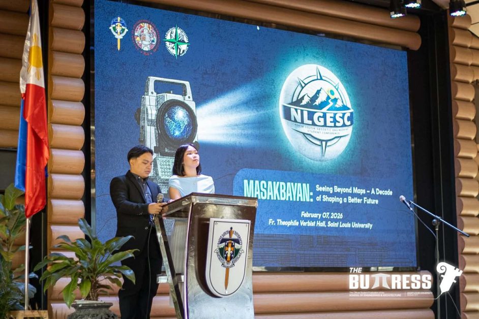
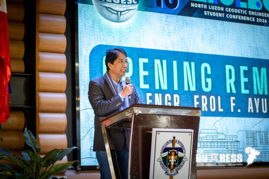
The first day of the event began with a prayer invocation and singing of the national anthem by the members of MUSICEA, quickly followed by welcoming remarks from SEA Associate Dean, Engr. Caroline Bautista. The opening remarks from Engr. Erol F Ayunon, a faculty member of Geodetic Engineering SLU also took place, including the introduction of the event’s theme. Delegates from different schools were introduced by the masters of the ceremony, Mr. Seanne Lander Racadio and Ms. Nicole Tulagan.
Guest speakers from civil engineering were invited, including a geodetic engineer from the SLU campus.
Engr. Nathaniel Vincent A. Lubrica, a licensed civil engineer, delivered the first technical session. He holds a Doctor of Philosophy in Rural Development from Benguet State University, a Master’s degree in Environmental and Habitat Planning, and a Bachelor of Science in Civil Engineering from SLU. Engr. Lubrica discussed the significance and applications of geomatics across sectors, including Geographic Information System (GIS) use in planning and development, disaster risk management, transportation, and more.
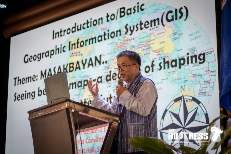
Engr. Simeon L. Micklay, the second speaker, is a civil engineer and public servant with over 30 years of experience in engineering, land administration, and forest management. He serves as Development Management Officer IV and Section Chief of the Patents and Deeds Section at DENR–CAR, and holds a Master of Science in Civil Engineering from the University of the Cordilleras. He provided an in-depth discussion of GIS, including what it is, how it works, and its key functions in the community.
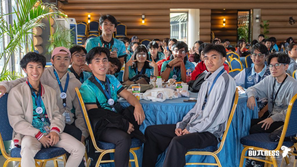
In between sessions and breaks, AGES conducted ice breaker activities like small quizzes and raffles to keep the delegates entertained along with the floor masters. Small talks were also facilitated.
Before the last technical session, AGES initiated a Campus Tour for the delegates with the aim of introducing several key locations of SLU. After the tour, the delegates returned to Fr. Theophile Verbist Hall for the last technical session of the day by Engr. Rick Arellano.
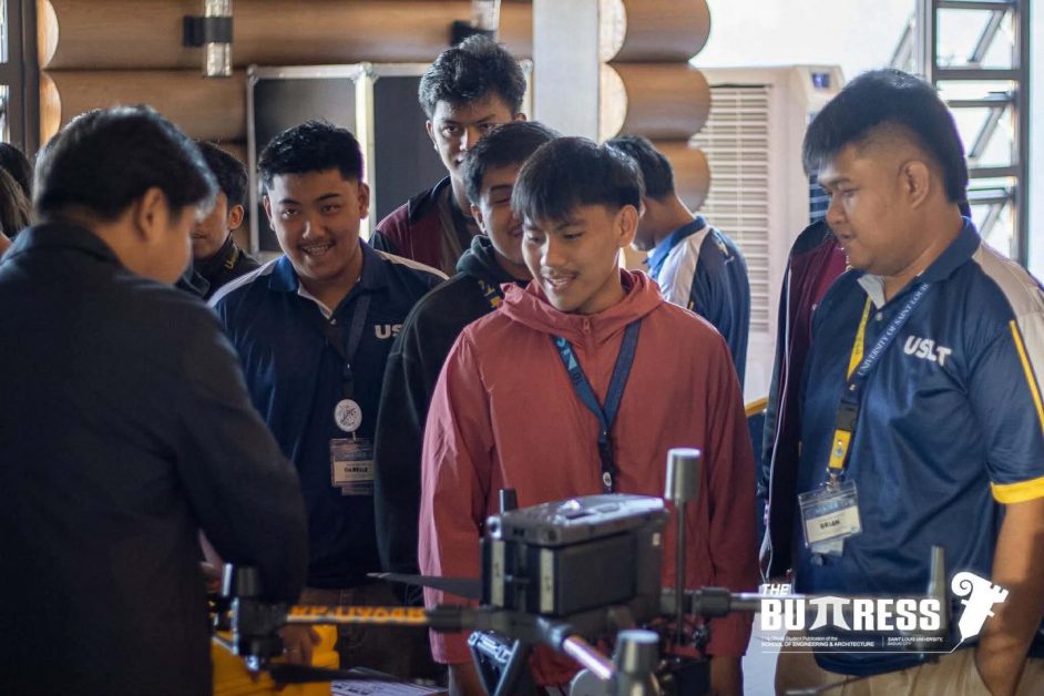
A skilled professional in geodesy, surveying, and geographic information systems, Engr. Arellano is pursuing a Master’s degree in Geomatics for Disaster Risk Reduction at the University of the Cordilleras and serves as a part-time faculty member at SLU. He shared his expertise on mapping basics using drones and LiDAR technologies, explaining their importance, applications, and efficiency in geodetic surveying.
The day concluded with reminders for the second day of the event.
On the second day, participants gathered early to prepare for another full day of the conference.
After the invocation and national anthem, Engr. Lovely Ranosa, Head of the Civil and Geodetic Engineering Department, delivered the welcoming remarks. Engr. Apolonio Jr. Walsiyen, a faculty member in the geodetic engineering program, followed with opening remarks to formally launch the conference.
Engr. Andrei Corpus, a representative from TOPCON Positioning Asia and an SLU Geodetic Engineering alumnus, led the first industry session. He discussed and promoted the latest information and communication technologies for geodetic surveying, highlighting their efficiency and speed in applications like construction, as-built surveys, topography, and more.
The conference concluded with Engr. Jonathan Han from Tecphil Surveying and Mapping Services (main office in Tuguegarao). He covered advanced drone equipment and LiDAR scanners, emphasizing their advantages over the limitations of outdated tools in aerial surveys.
The event conducted its PaGElingan Quiz Bee, showcasing the participants’ knowledge and quick thinking with consideration to the recent GELE board curriculum. All invited schools, except for SLU, participated in the quiz bee.
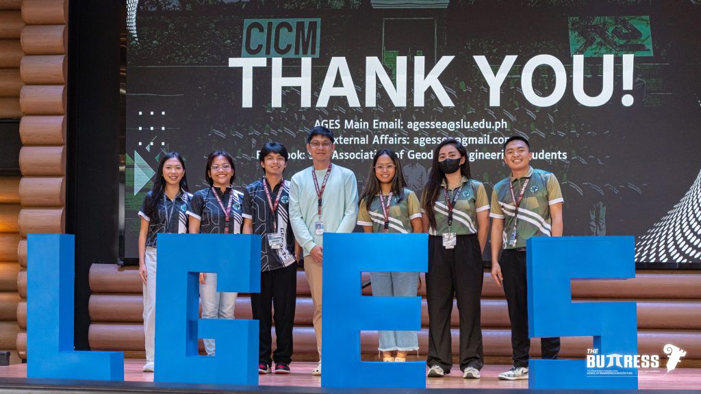
Ms. Faith Hohilla, AGES President, then delivered closing remarks, thanking participants and everyone who made the event a success. AGES presented certificates to all participants as a token of appreciation.
The event concluded with a lively community dance led by Mr. Joshua Daniel and delegates from MPSU.


The event aligned with several Sustainable Development Goals (SDGs). It advanced SDG 4 (Quality Education) by enhancing geodetic engineering students’ knowledge and skills in geomatics and GIS through technical sessions. Industry sessions featured discussions on advanced technologies, while the PaGElingan Quiz Bee tested and sharpened participants’ knowledge and critical thinking.
The conference also supported SDG 16 (Peace, Justice, and Strong Institutions) by fostering dialogue, raising awareness, and empowering students to promote peace, inclusivity, and justice in their profession.Finally, it exemplified SDG 17 (Partnerships for the Goals) through networking, collaboration, and regional integration among students, professionals, companies, and organizations. Multiple sponsorships underscored the value of partnerships in driving the event’s success.
Overall, the 10th North Luzon Geodetic Engineering Students Conference was a success, along with the achievement of the aligned sustainable development goals.
Sponsors included the National Geodetic Engineers of the Philippines Inc. (GEPI), Review Innovation, Topcon Positioning Asia, and Tecphil Geosolutions Co.
The event was made possible through the support of Engr. Romel Dungca, Engr. Divine Grace Morales, Engr. Edwardson Ruaro, Engr. Frank Kevin Saldivar, Engr. Alec John Naoe, Engr. Edwin Moreno, and Engr. Edspencer Moreno. Special thanks go to the SLU Civil and Geodetic Engineering Department, MUSICEA, Philippine Institute of Civil Engineers SLU-Student Chapter (PICE SLU-SC), University Information Office (UIO), and media partner The Buttress.(Article by: SLU-AGES and Photos by: The Buttress)